octopusgames
Research/Fieldwork · visual localization
RESEARCH · GENERATION 2 · DIGITAL SHADOW
Fieldwork — visual localization in a synthetic world
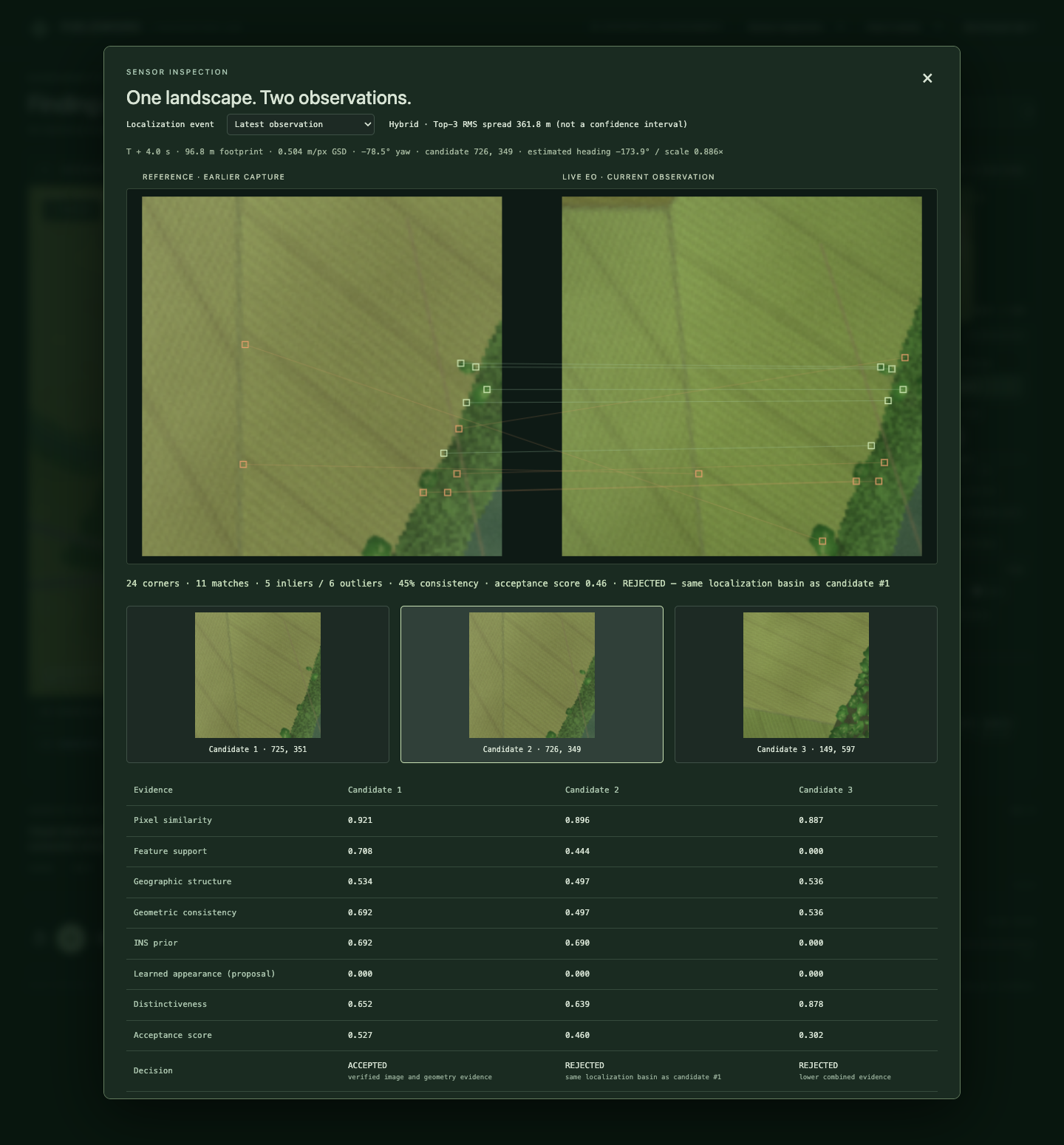
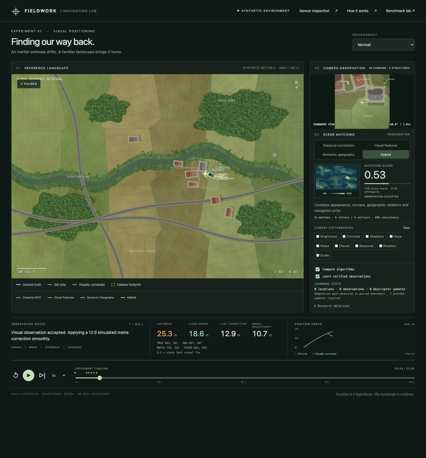
Where is the vehicle, given only what its camera sees? Reference and live images are independent renders of the same latent terrain; four real matching algorithms, geographic-structure extraction, candidate-evidence inspection, protected observation memory, learning replay and ablations are evaluated under a fixed protocol. Truth is held by the evaluator only. Open the live sandbox →
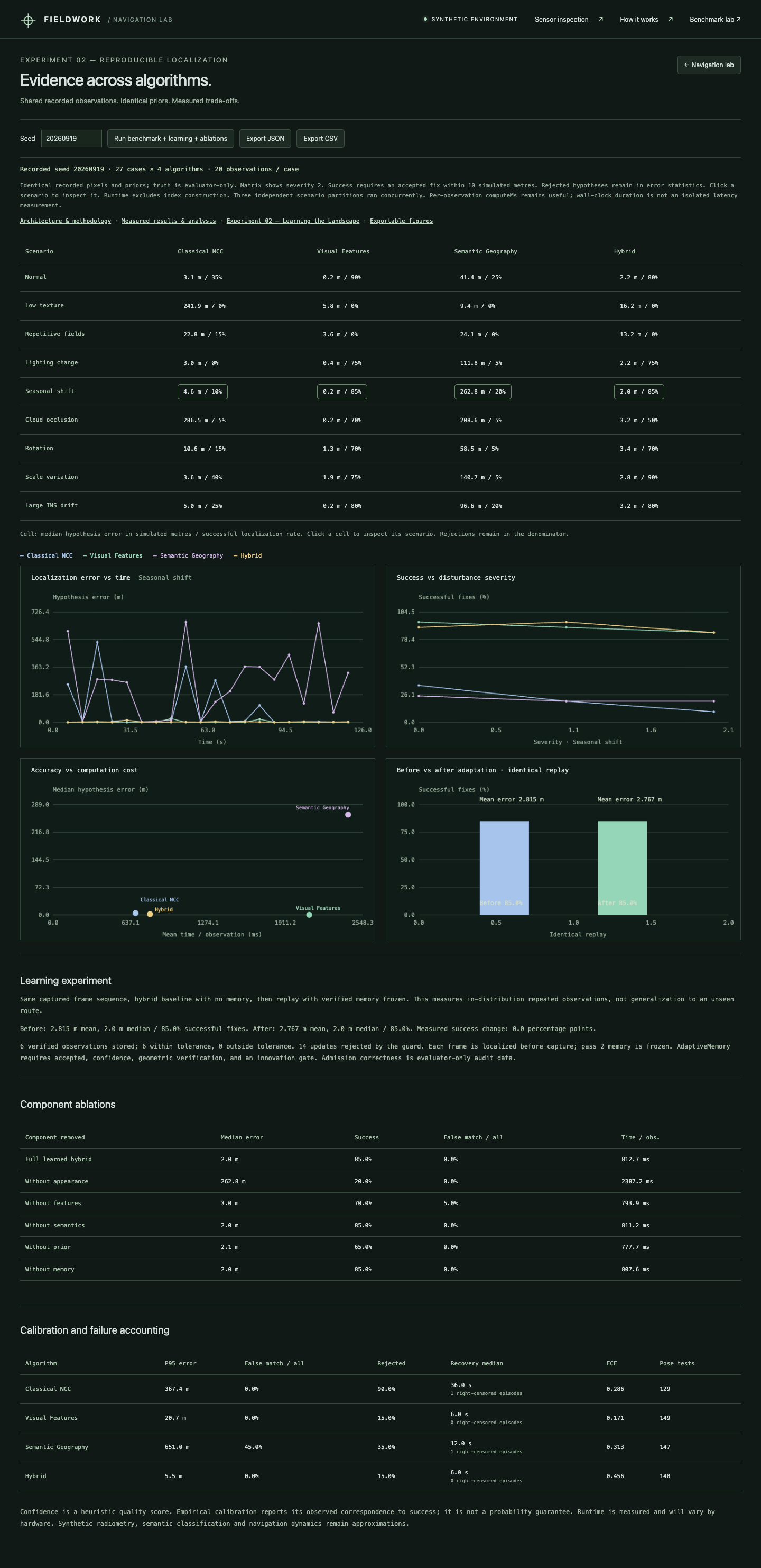
27scenario cases (9 scenes × 3 severities)
2,300evaluation records
4algorithms: classical NCC · local features · semantic geography · hybrid
33 / 33automated tests + browser validation
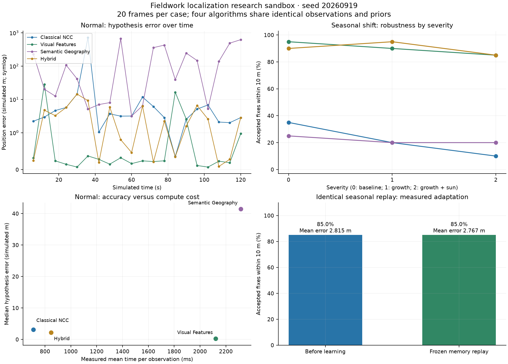
2.815 → 2.767 mmean error after learning replay (simulated metres)
17 / 20successful accepted fixes, unchanged by learning (85 %)
6 / 0memory admissions / wrong admissions
What was found
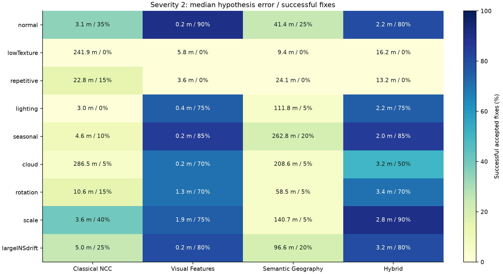
- Hybrid localization succeeds on 19/20 observations at severities 0–1 and 16/20 at severity 2; it rejects all low-texture observations and refuses the intentionally ambiguous repetitive scene instead of claiming a plausible but unsupported fix.
- Learning replay (seasonal, exact-frame) improves mean all-hypothesis error from 2.815 m to 2.767 m with no change in success rate; six observations entered frozen memory, all audited correct, zero wrong admissions.
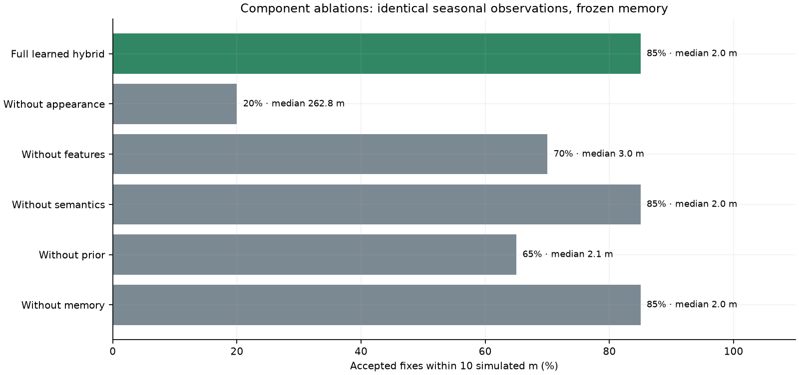
- Ablations on the same engine: removing appearance collapses success to 4/20 (252 m mean error); removing the prior 13/20; removing features 14/20 with one false accept; removing memory returns the baseline.
- Pure semantic matching mismatches visibly, and removing semantic evidence in the seasonal replay left the recorded positions unchanged — a later event-level audit found two acceptance decisions exchanged with zero net gain. These failures are kept and analysed, not hidden.
- The report separates real computation from illustrative models; confidence remains a heuristic score, not a calibrated probability.
Reports
Architecture, algorithms and methodologyInformation boundaries, geographic representation, the four localizers, learning protection, experimental protocol, computed vs illustrative
V4 benchmark resultsMain findings, severity-2 comparison, learning and counterfactual ablations, calibration and limits, validation
Experiment 02 — Learning the LandscapeLearned geometry, information gain, when information reduction misleadsExperiment 02 — fixed protocolQuestions set before measuring, controls, information accounting, freeze and reproducibility
Figures